Mancos Watershed Stream Management Plan
After three years of collaborative effort, the MWG is excited to share the final Mancos Watershed Stream Management Plan with you. The MWSMP is a comprehensive community-based strategy designed to support long-term ecological resilience, agricultural viability, and preservation of local identity. The focus of this plan is to improve water-use efficiency, restore riparian and forested areas, improve infrastructure, and expand watershed-related education that incorporates agricultural and Indigenous knowledge. The MWSMP details existing conditions, resource concerns, management goals, and recommends key actions and projects to meet community-identified goals.
Seventy-five projects were identified through this process to support and enhance watershed conditions through a variety of ways. These projects represent a comprehensive set of actions for stakeholders and partners to fund and implement. Several of the identified projects have been funded and progress began, prior to the publication of the MWSMP.
In the Google Folder linked above, you will find the final the following:
Mancos Watershed Stream Management Plan
MWSMP Executive Summary
Appendix A - Recommended Actions that are Directly Related to Watershed Health
Appendix B - Recommended Actions that are Indirectly Related to Watershed Health
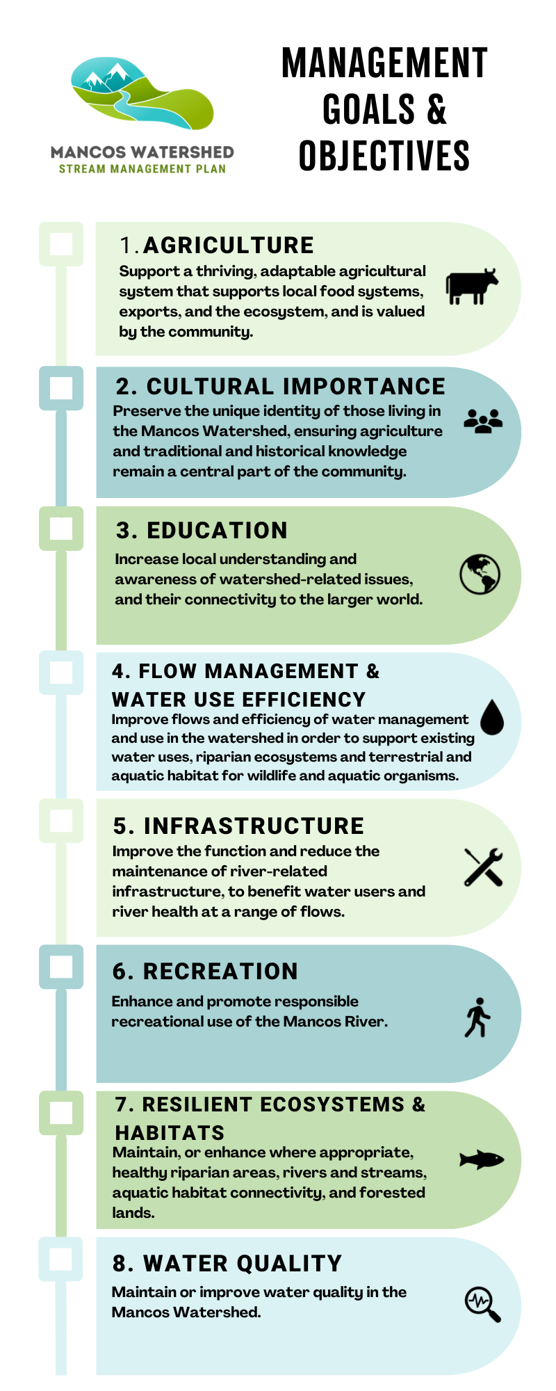
Appendix C - Management Goals & Objectives
Appendix D - Data Sources and Summaries
Draft Documents
Other related resources from the MWSMP Process
Community Values
Some Background Info
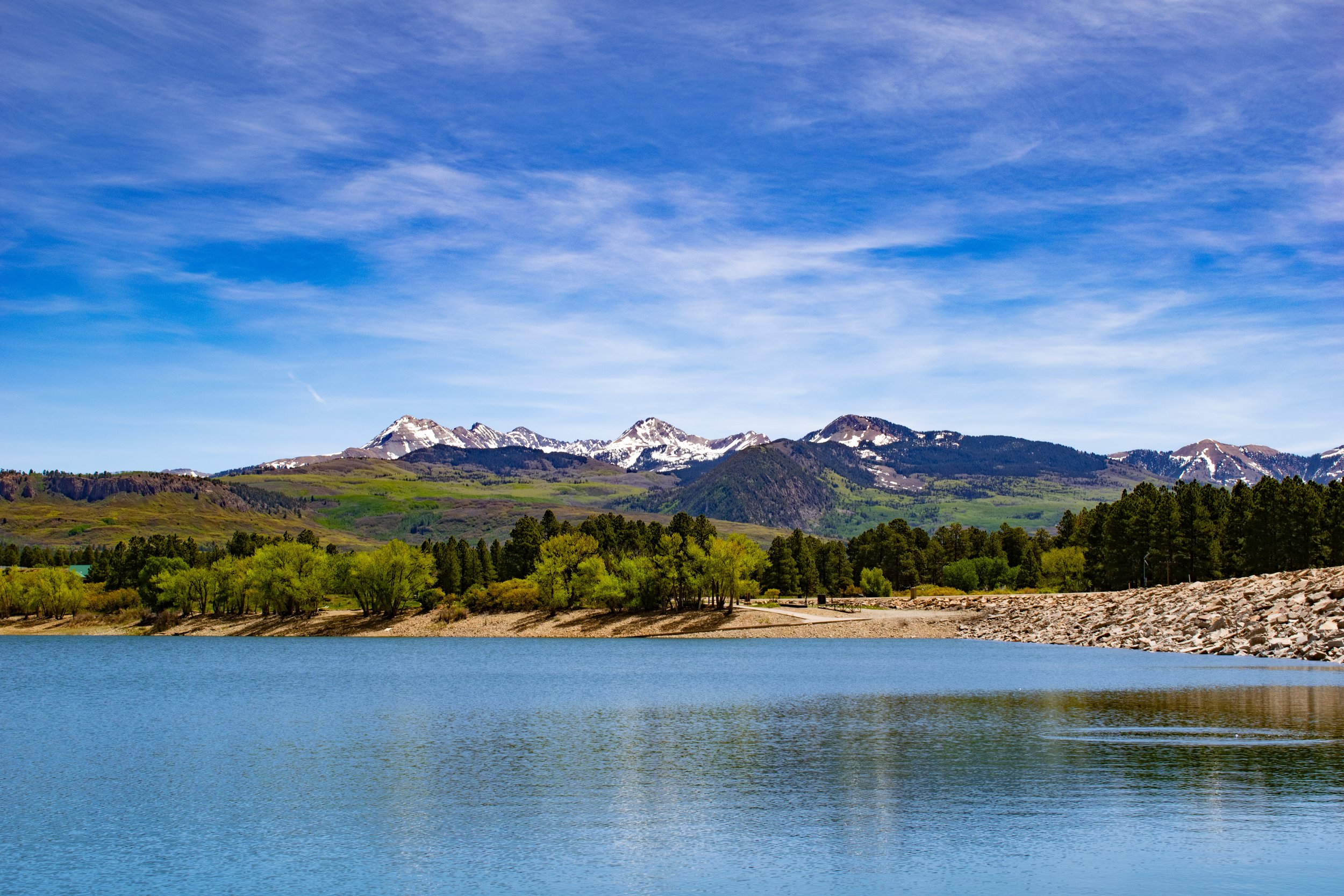
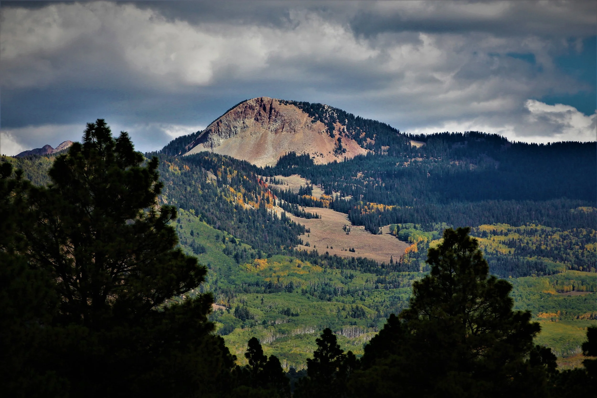
The Mancos Watershed Stream Management Plan seeks to improve water security for all water uses and values in the Mancos Watershed by protecting existing uses, meeting user shortages, and maintaining a healthy riverine ecosystem. The geographic focus of this effort is the entire Mancos River watershed and its main tributaries. This diverse area encompasses Forest Service lands and Bureau of Reclamation facilities at the top end of the watershed, a productive irrigated valley in the middle, and Tribal and National Park lands towards the bottom end.
The specifics of climate uncertainly - like warmer temperatures, more frequent droughts. and variability of rainfall, paired with the vulnerability of forest and water resources to increased wildfire risk and severity precipitate the need for a stream management plan. Changes in land use and crop types may change historic surface flow patterns and exacerbate existing concerns about river health and flow shortages. A growing emphasis on recreation and community-wide engagement with the river further demand forward and collaborative thinking and planning.
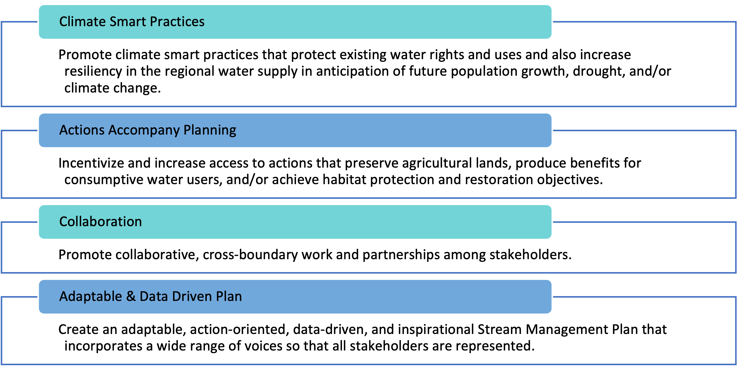
The overarching goals of this first phase are to ensure protection of the current water rights, continued outreach and engagement, and to identify river health, recreational, and management opportunities on lands along the Mancos River through modeling, assessments, and monitoring coordination. The second phase will use data and information gathered during Phase I and beyond to assess, identify, and prioritize projects that further goals of the SMP. The objectives for Phase II propose building upon Phase I to provide recommendations for increased flows and restoration opportunities, identify potential projects for new and improved infrastructure, and facilitate changes to irrigation uses during below average run-off years. These opportunities, alongside those not yet anticipated, will incorporate the USBR Drought Resilience project's decision support framework to identify climate smart opportunities and future climate as a variable in the prioritization and implementation process.
Our Partners:
Mancos Conservation District (MCD), Ute Mountain Ute Tribe (UMUT), Mesa Verde National Park (MVNP), Town of Mancos (ToM), Mancos Water Conservancy District (MWCD), Mancos Watershed Group (MWG), Mountain Studies Institute (MSI)

Stream Management Plans
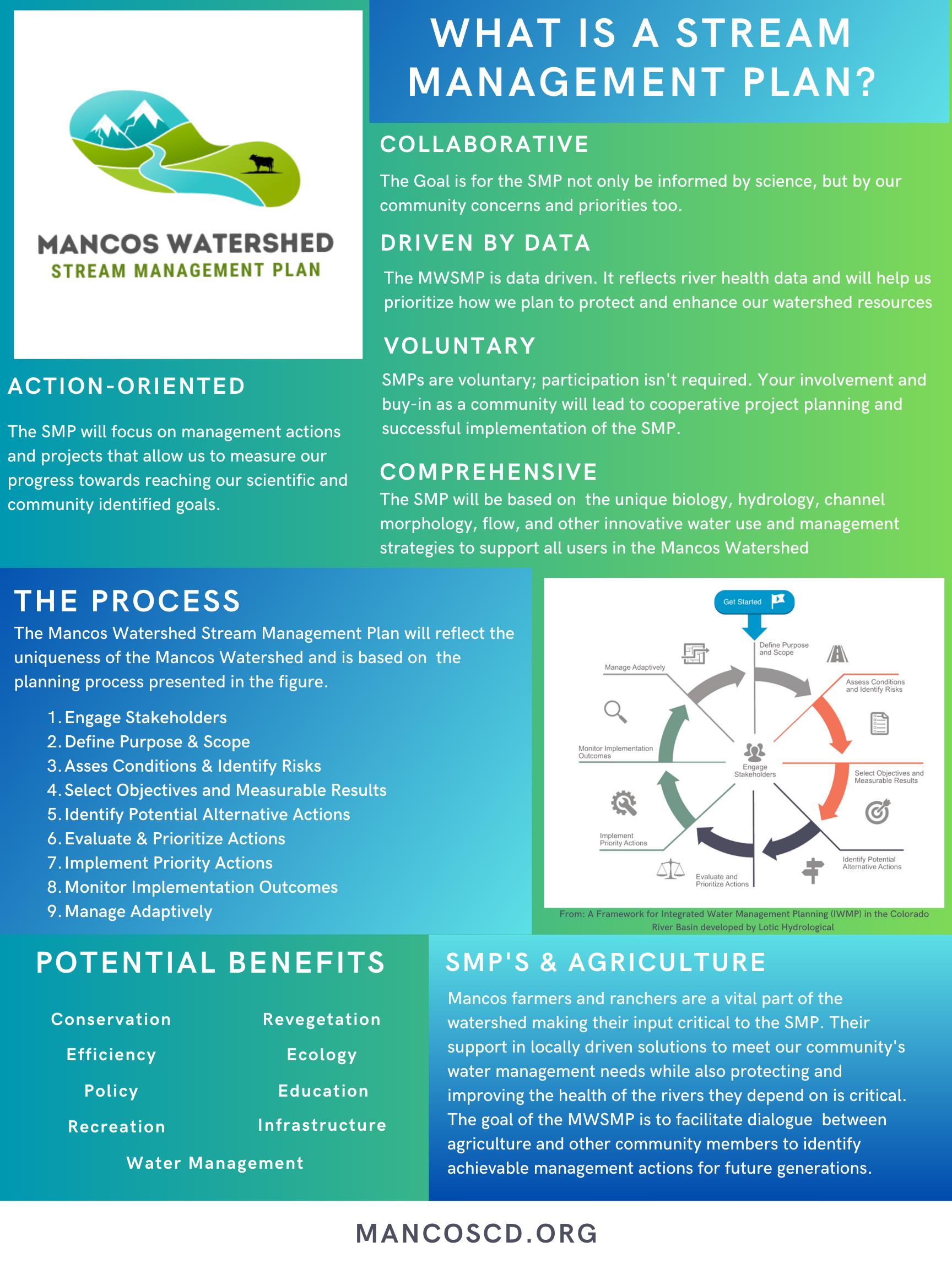
According to the Colorado Water Conservation Board, stream management plans are: “data-driven assessments of river health that help communities prioritize how to protect or enhance environmental and recreational assets in their watershed." In the case of the Mancos Watershed, stream management planning efforts also seek to identify opportunities for increased agricultural efficiencies and improved infrastructure.

Fluvial Hazard Zone Mapping
Fluvial Hazard Zone (FHZ) is the area a stream has occupied in recent history, may occupy, or may physically influence as it stores and transports water, sediment, and debris.
Fluvial geomorphic processes are natural phenomena within stream corridors and include commonly observed occurrences such as erosion, the transport and deposition of sediment, the recruitment and jamming of wood, and the structural influences of plants and animals.
Fluvial geomorphic processes become hazardous when they encounter infrastructure, houses, businesses, and other investments within and adjacent to the stream corridor. Fluvial Hazard Zone Maps are created by fluvial geomorphologists through the interpretation of data that describes the physical location, form, flooding intensity, active sediment and debris transport, and ecological conditions of the river system.
Fluvial Hazard Zone maps provide communities, property owners, and emergency response teams with information on flood- and stream- related hazards beyond those identified by traditional floodplain mapping. Additionally, as stream corridors are environmentally and economically important areas, Fluvial Hazard Zone maps can aid in prioritizing lands for conservation or maintenance of fluvial hazard compatible land uses.
Ag Producer Survey
The Mancos Conservation District has also partnered with Sarah McCarthy, a graduate student with Northern Arizona University and the Intermountain West Transformation Network to offer a survey for agricultural producers in Montezuma County.

